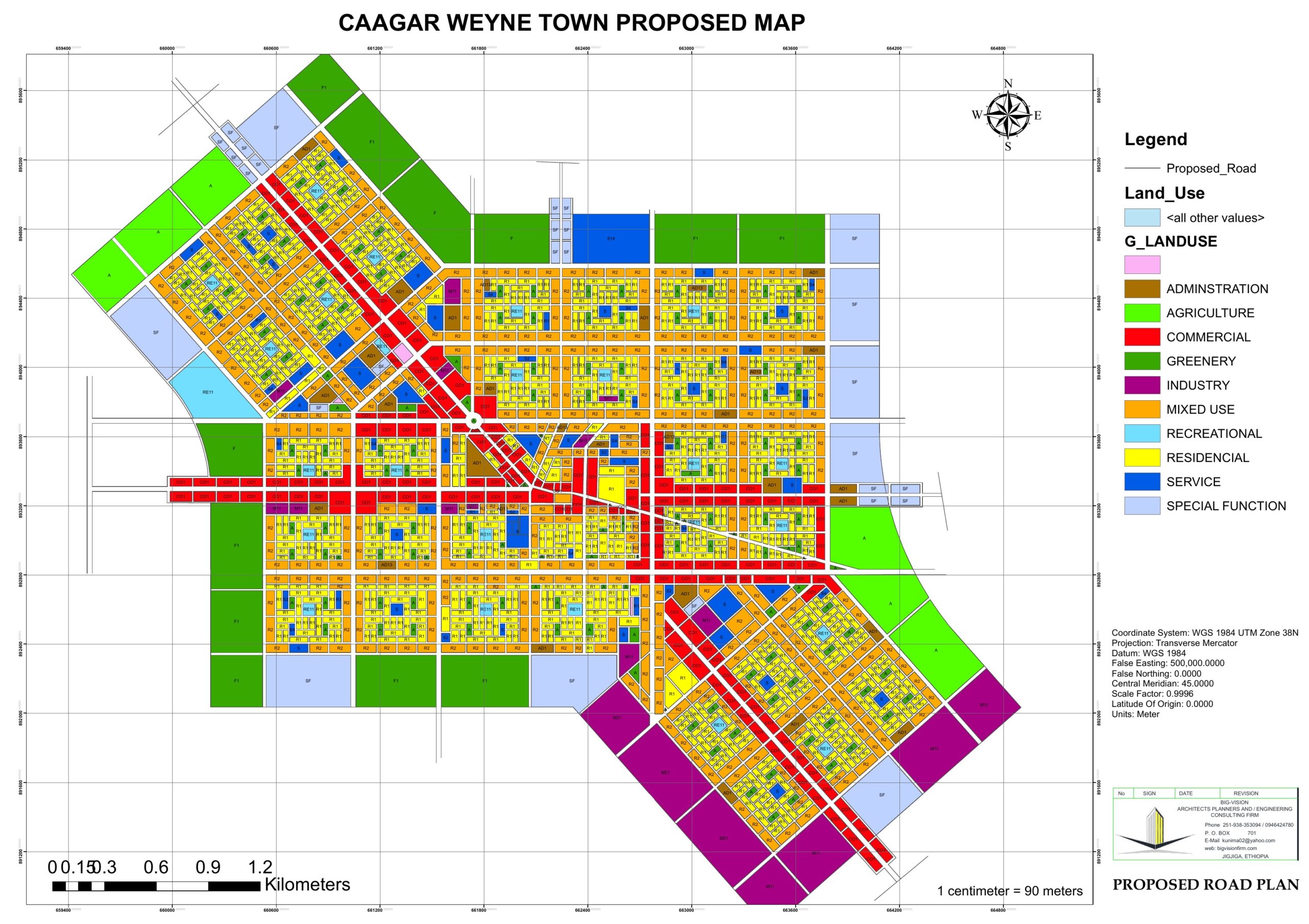

A proposed land-use layout and road network guiding coordinated urban development in Caagar Weyne.
The Caagar Weyne Master Plan sets out a proposed land-use layout and road network to guide the town’s development.
The plan integrates residential and mixed-use neighbourhoods with commercial areas, administrative facilities, public services and industrial zones. It also allocates space for recreation, greenery, agriculture and special functions, providing a framework for coordinated urban growth.
The source map credits Big-Vision Architects, Planners and Engineering Consulting Firm.
Development plan map